
Dewanto , Ordas (1994) Menentukan kekebalan lapisan lapuk dengan menggunakan metode multiloyer ( seismik refraksi ) di daerah " X " Jawa barat. Undergraduate thesis, FMIPA Undip.
![[img]](/style/images/fileicons/application_pdf.png) | PDF Restricted to Repository staff only 3469Kb | |
| PDF 17Kb | |
| PDF 359Kb | |
| PDF 447Kb | |
| PDF 364Kb | |
| PDF 655Kb | |
| PDF 717Kb | |
| PDF 506Kb | |
| PDF Restricted to Repository staff only 487Kb | |
| PDF 336Kb | |
| PDF 344Kb | |
| PDF 1920Kb |
Abstract
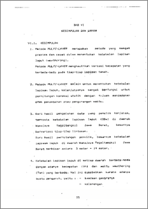
ABSTRACT Weathering Zone Survey is survey which is done to determining weathering layer thickness. Under this weathering layer thickness would be placed dylwim.it as seismik wave source. The purpose which source is placed under weathering layer is : - In order to receive high energy and frequency not to be. damped. - In order to make the penetration to be deeper. - In order to have good seismic' data, as long with make use of explode power effeciently. - Because characteristic of weathering layer are 2 1. High frequency damping. 2. Low Velocity Zone (LVZ). 3. Unconsolidated Layer. Determining depth of the weathering layer is also very important for measuring static correction. Methods are used to calculate or determine the thickness of weathering layer, is Multi-Layer methods (refraction seismic). Multi-Layer methods produc velocity variations which is different for different soil layer. From the data processing results, we find thickness of weathering layer vary in different path. Getting the find results, we find that the thickness of weathering layer in Wanajaya-Tegaltangkil area is approximately beetween 3-19 meters. Survey Weathering Zone adalah survey yang dilakukan untuk menentukan ketebalan lapisan lapuk. Di bawah ketebalan lapisan lapuk inilah nantinya akan ditempatkan dinamit sebagai source gelombang seismik. Tujuan source ditempatkan di bawah lapisan lapuk adalah : - agar diperoleh energi yang tinggi dan sehingga frekuensinya tidak teredam. - diharapkan mempunyai penetrasi yang dalam. - agar diperoleh data seismik yang bagus, serta pemanfaatan tenaga ledak yang lebih efisien. - Karena sifat dari lapisan lapuk adalah : 1. Meredam frekuensi tinggi. 2. Low Velocity Zone (LVZ) 3. Unconsolidated Layer. Penentuan kedalaman lapisan lapuk juga bertujuan untuk perhitungan koreksi statik. Metode yang digunakan untuk menghitung atau menentukan ketebalan lapisan lapuk ini, adalah metode Multi-Layer (Seismik Refraksi). Metode Multi-Layer menghasilkan variasi kecepatan yang berbeda-beda dari tiap-tiap lapisan tanah. Dari hasil pengolahan data, diperoleh besarnya ketebalan lapisan lapuk bervariasi untuk tiap-tiap lintasan. Dari hasil perhitungan diperoleh besarnya ketebalan lapisan lapuk di daerah Wanajaya Tegaltangkil berkisar antara 3 meter sampai dengan 19 mete
| Item Type: | Thesis (Undergraduate) |
|---|---|
| Subjects: | Q Science > QC Physics |
| Divisions: | Faculty of Science and Mathematics > Department of Physics |
| ID Code: | 30242 |
| Deposited By: | Mr UPT Perpus 1 |
| Deposited On: | 24 Oct 2011 14:36 |
| Last Modified: | 24 Oct 2011 14:36 |
Repository Staff Only: item control page
