
Riyanto , Bambang (2001) Interpretasi data Anomali Medan Magnet Total daerah Gunung Batur Bali menggunakan paket program Inversi model Prisma Tegak Tiga Dimensi. Undergraduate thesis, FMIPA UNDIP.
![[img]](/style/images/fileicons/application_pdf.png) | PDF Restricted to Repository staff only 3161Kb | |
| PDF 20Kb | |
| PDF 366Kb | |
| PDF 517Kb | |
| PDF 424Kb | |
| PDF 1001Kb | |
| PDF 458Kb | |
| PDF Restricted to Repository staff only 1285Kb | |
| PDF 328Kb | |
| PDF 359Kb | |
| PDF 780Kb |


Abstract
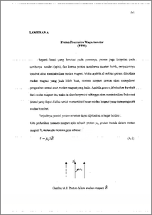
Telah dilakukan pengolahan dan interpretasi data anomali medan magnetik total Gunung Batur yang terdiri atas 159 titik pengamatan pada lokasi geografis 115.280° BT — 115.494° BT dan 8.119° LS — 8.343° LS. Anomali medan Magnet diperoleh melalui koreksi harian, koreksi 1GRF pada intensitas medan magnet total. Untuk menghilangkan efek topografi maka data anomali medan magnet total direduksi ke bidang datar kemudian dilakukan kontinuasi ke atas pada ketinggian 2000 m di atas mean sea level yang berguna untuk mengeliminasi efek lokal. Interpretasi kualitatif dilakukan dengan mentransformasikan data magnetik ke data gravitasi kemudian menganalisa gradien horisontalnya. Dari gradien horisontal maksimum diperoleh letak benda anomali di sebelah utara puncak Gunung Batur. Sedangkan interpretasi kuantitatif dilakukan dengan paket Program Inversi Model Prisma Tegak Tiga Dimensi diperoleh sumber magnetik berada di sebelah utara puncak Gunung Batur. Benda magnetik berukuran 1.12 km berarah Utara-Selatan, 1.3 km berarah Timur-Barat, ketebalan 0.23 km berada pada kedalaman maksimum 0.65 km di bawah puncak Gunung Batur dengan susceptibilitas magnetik 0.0087 cgs (0.109 SI) dan volume benda 0.335 1=3. Benda magnetik ditafsirkan merupakan kantong magma Gunung Batur dengan batuan intrusif magma adalah batuan basalt andesit bersifat asam. A processing and interpretation have been done to the total magnetic field data consist of 159 observation point on Mount Batur. The research area is located at geographic position of 115.280° E — 115.494° E and 8.119° S — 8.343° S. The__magnetic field anomaly was obtained by means of diurnal correction IGRF corecction at the total magnetic field anomaly In order to eliminate the topographic effect, the total magnetic field anomaly data was reducted to flat plane, after wards the upward continuations was applied at 2000 m elevation above mean sea level. The qualitative interpretation was carried out by transforming the magnetic data into gravity data and analysis horizontal gradient. From the maximum horizontal gradient, the anomaly body is found lying at the north of the Mount Bator peak. Meant while, the quantitative interpretation was conducted by means of 3-D inversion model in which the magnetic source was found located at the north of the mount peak The magnetic body measures 1.12 km in th direction of North-South, 1.3 kmin the direction of East-West, width of 0.23 km located at the maximum depth of 0.0087 cgs (0.109 SI) and the volume of 0.335 km3. The magnetic body is interpreted as magma chamber with the magmatic intrussif rock is the acid andecit basaltic rock.
| Item Type: | Thesis (Undergraduate) |
|---|---|
| Subjects: | Q Science > QC Physics |
| Divisions: | Faculty of Science and Mathematics > Department of Physics |
| ID Code: | 30541 |
| Deposited By: | Mr UPT Perpus 1 |
| Deposited On: | 01 Nov 2011 15:18 |
| Last Modified: | 01 Nov 2011 15:18 |
Repository Staff Only: item control page
